
Research / Observations / Lake Poopó, Bolivia, August 2017 and August 2025

2017-08-07

2025-08-15
Lake Poopó, Bolivia, August 2017 and August 2025
Late dry-season views of the basin in 2017 and 2025 show the extent of exposed salt and playa relative to open water, and the partial recovery of the lake over eight years.
- Place
- Lake Poopó, Oruro, Bolivia
- Coordinates
- -18.7500, -67.1000
- Acquired
- 2017-08-07 and 2025-08-15
- Region
- Bolivia, Oruro
- Satellite
- Sentinel-2, true color
- Source
- Sentinel-2 Level-2A true-color image, four tiles (19KFU, 19KFV, 19KGU, 19KGV), relative orbit 96
- Catalog
- Microsoft Planetary Computer STAC, collection sentinel-2-l2a
- Resolution
- 60 m ground sample distance
- Scenes
8 scene IDs
S2A_MSIL2A_20170807T143751_R096_T19KGV_20210210T205804,S2A_MSIL2A_20170807T143751_R096_T19KGU_20210210T205759,S2A_MSIL2A_20170807T143751_R096_T19KFV_20210210T205803,S2A_MSIL2A_20170807T143751_R096_T19KFU_20210210T205755,S2C_MSIL2A_20250815T143801_R096_T19KGV_20250815T191413,S2C_MSIL2A_20250815T143801_R096_T19KGU_20250815T191413,S2C_MSIL2A_20250815T143801_R096_T19KFV_20250815T191413,S2C_MSIL2A_20250815T143801_R096_T19KFU_20250815T191413- Rights
- Contains modified Copernicus Sentinel data 2017, 2025. Copernicus Sentinel data is free, full, and open. Rendering by Heimdall Research.
- Credit
- Contains modified Copernicus Sentinel data 2017, 2025.
- Published
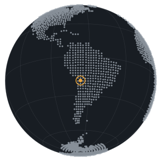
What this shows
Lake Poopó lies on the Bolivian Altiplano at about 3,700 meters, fed mainly by the Desaguadero River from Lake Titicaca. It is shallow and saline, with no outlet, so its size swings with rainfall and upstream use. In late 2015 it dried almost completely, an event widely reported at the time. These two frames are taken at the end of the dry season, when the lake is at its smallest each year, eight years apart. The 96 by 54 km window covers the whole lake; bright white is salt crust and dry lakebed, green and brown areas are shallow, sediment-laden water.
Lake Poopó is not in the Western Terminal Lakes dataset, which covers terminal lakes in the western United States. The same method applies to it. The monthly area for this basin is not in the published lakes table.
Prints
Every print carries the place, the date, and the source credit on the mat, as shown. Sizes and paper are quoted with the rights and source resolution confirmed.


Related
-
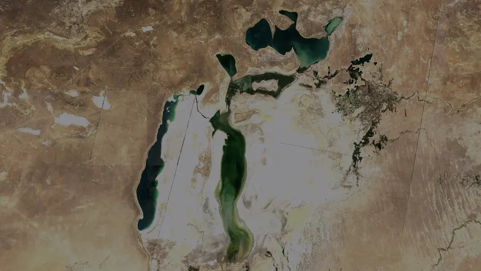
Aral Sea, Kazakhstan and Uzbekistan, 2017 and 2025
Late-summer true-color views from 2017 and 2025 show the North Aral, the western and eastern basins, and the exposed seabed between them.
Prints and analysis
Prints are quoted once rights and source resolution are confirmed. Analysis requests get a direct answer about what the imagery can and cannot show.
Method and sources
Two Sentinel-2 scenes, 7 August 2017 and 15 August 2025, were aligned and brightness-matched. Both are from the end of the dry season. Bright areas are salt crust and dry lakebed.